We buy houses across Northeast Ohio

Menu

CLEVELAND NEIGHBORHOOD WALKABILITY GUIDE

Cleveland Neighborhoods Where Walking and Daily Life Connect

Compare eight Cleveland areas by their main corridors, transit connections, parks, trail access, and housing tradeoffs. The goal isn't to name one winner. It's to show how the city's neighborhoods and districts differ before you narrow the search to a specific address.

Eight Cleveland areas. Real corridors and connections. No one-size-fits-all neighborhood ranking.
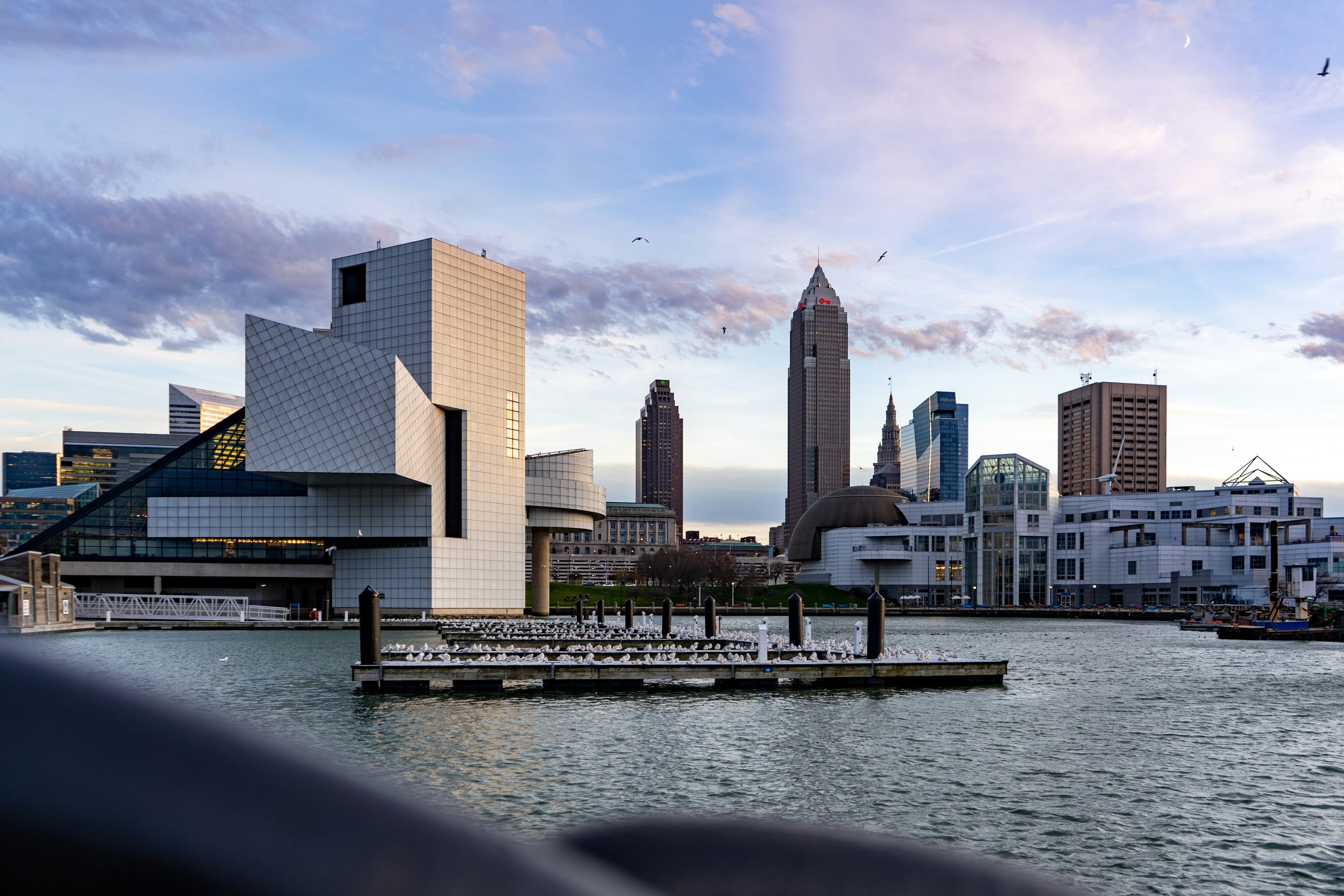

Downtown Cleveland skyline viewed across the waterfront
DOWNTOWN CLEVELANDThe skyline, river, bridges, and street grid all shape how the city connects.
Rock and Roll Hall of Fame building in Cleveland
North Coast Harbor
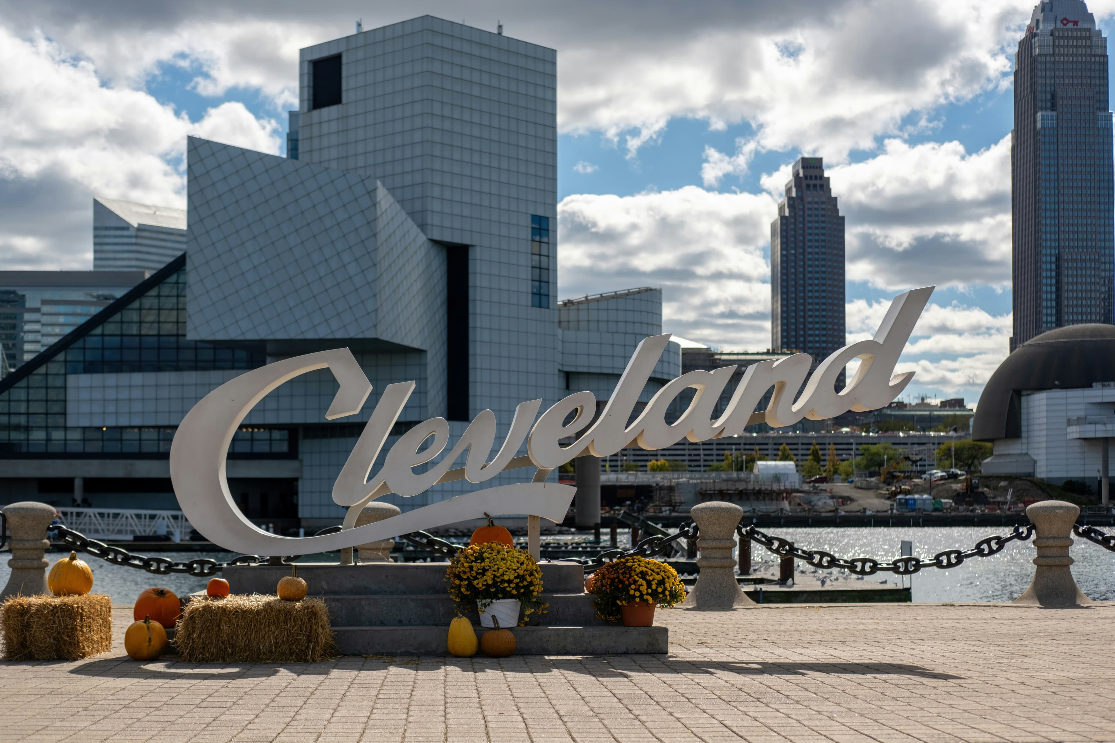
Cleveland script sign with the downtown skyline beyond
Cleveland waterfront

COMPARE THE EVERYDAY DETAILS

What to Compare Between Cleveland Neighborhoods

One Cleveland neighborhood may put restaurants nearby while another offers a stronger transit, park, or trail connection. These six details make the comparison more useful.

01

Useful destinations

Groceries, medical care, transit, parks, services, and other places you actually use need separate route checks.

02

Connected streets

Short blocks and multiple route choices can help, while dead ends, highways, rivers, and rail lines can add distance.

03

Crossings and traffic

A nearby destination can still be difficult to reach when the route includes wide roads, long signals, or uncomfortable crossings.

04

Transit usefulness

Check service frequency, operating hours, transfers, alerts, and the walk to the useful stop, not only the nearest stop marker.

05

Trails and public space

A trail may help with one trip but not groceries or work. Confirm entrances, hours, winter maintenance, and route continuity.

06

Access in every season

Curb ramps, surface condition, hills, lighting, snow, ice, construction, and individual mobility needs all affect the real trip.

CLEVELAND AT A GLANCE

Eight Cleveland Areas Side by Side

Start with the neighborhood or district, then compare its main destinations, transit connections, park access, and the details that can change from one block to the next.

Civic core

Downtown

01
Main corridor
Public Square and Euclid Avenue
Transit
Tower City is a major rail and bus connection. The HealthLine follows Euclid Avenue, and other routes use the downtown street network. Event service, detours, and the useful entrance should be checked for the actual trip.
Verify
Walk from the building entrance to groceries, transit, parking, and the destinations you expect to use after normal business hours.

West-side hub

Ohio City

02
Main corridor
West 25th Street and Lorain Avenue
Transit
The West 25th-Ohio City Red Line station and multiple bus routes connect the area. Distance, crossing conditions, service alerts, and the return trip vary by address.
Verify
Test whether the address is actually close to everyday needs or mainly close to dining and entertainment. Check parking and historic review separately.

Compact hilltop district

Tremont

03
Main corridor
Professor Avenue and Lincoln Park
Transit
Bus routes provide the main transit access in the neighborhood core. A rail station may require a longer walk or a transfer depending on the starting block.
Verify
Walk the hills, major crossings, and trail connection you would really use. Check whether limited parking or a steep route changes the daily plan.

Neighborhood and arts district

Detroit Shoreway and Gordon Square

04
Main corridor
Detroit Avenue, West 65th to West 78th
Transit
Bus service follows the main corridors, and the West 65th-Lorain Red Line station sits south of Detroit Avenue. The station walk is more useful from some blocks than others.
Verify
Measure the route to the Red Line and the actual park entrance, not only the straight-line distance. Check whether Detroit Avenue meets daily needs beyond entertainment.

Institutional district

University Circle

05
Main corridor
Euclid Avenue and Wade Oval
Transit
The HealthLine serves Euclid Avenue. Red Line access is available at Little Italy-University Circle and Cedar-University, but the more practical station depends on the exact origin and destination.
Verify
Check the entrance you must use, construction detours, large intersections, and whether the walk remains practical outside peak institutional hours.

Compact neighborhood district

Little Italy

06
Main corridor
Mayfield Road and Murray Hill Road
Transit
The Little Italy-University Circle Red Line station serves the district, and HealthLine service is reachable along Euclid Avenue. The walk can include a hill and station-specific access points.
Verify
Walk Murray Hill and the route to Euclid Avenue or the Red Line. Confirm grade, stairs, parking, and accessibility needs at the building itself.

Lakefront planning area

Edgewater

07
Main corridor
Clifton Boulevard, Detroit Avenue, and park entrances
Transit
Bus service uses Clifton and Detroit, including the Cleveland State Line on Clifton. Red Line stations are south of some portions of the neighborhood and may not be the simplest connection.
Verify
Map the legal park entrance and crossing rather than drawing a straight line to the lake. Test groceries, transit, and medical trips separately from recreation.

Transit-centered planning area

Buckeye-Shaker Square

08
Main corridor
Shaker Square and Shaker Boulevard
Transit
RTA Blue and Green Line service stops at Shaker Square, with bus connections nearby. Platform access, service changes, and the walk from an exact address should be checked directly.
Verify
Confirm whether the property is actually near Shaker Square or elsewhere in the larger planning area. Test the route across major intersections and review parking or shared-building obligations.

RTA schedules, alerts, station access, construction, and service patterns can change. Use the current RTA trip planner and City transportation resources before making a location decision.

CLEVELAND NEIGHBORHOOD PROFILES

Eight Cleveland Neighborhood Areas to Explore

Each profile starts with the part of the neighborhood people usually recognize, then adds the transit, public-space, housing, and block-level details worth comparing.

01

Civic core

Downtown

Public Square and Euclid Avenue

Downtown is an official City of Cleveland planning area. Public Square, Euclid Avenue, East 9th Street, and the Gateway area are useful orientation points, but a specific building can sit several blocks from the destination you need.

Destinations
Civic buildings, entertainment venues, public spaces, restaurants, and services are concentrated in several clusters rather than one continuous strip.
Transit
Tower City is a major rail and bus connection. The HealthLine follows Euclid Avenue, and other routes use the downtown street network. Event service, detours, and the useful entrance should be checked for the actual trip.
Trail or park link
Lakefront and river connections exist, but highways, rail lines, slopes, and limited crossings can make the route less direct than it appears on a map.
Housing pattern
Apartments, condominiums, and adaptive-reuse buildings are common. Review parking, move-in rules, association obligations, elevators, and responsibility for shared systems.

VERIFY AT THE ADDRESS

Walk from the building entrance to groceries, transit, parking, and the destinations you expect to use after normal business hours.

02

West-side hub

Ohio City

West 25th Street and Lorain Avenue

Ohio City is an official City planning area. West 25th Street and Lorain Avenue form a prominent destination cluster, but the neighborhood extends beyond the market district.

Destinations
The West Side Market area, Carnegie West Branch library, neighborhood services, restaurants, and public spaces create a concentrated walking district around West 25th Street.
Transit
The West 25th-Ohio City Red Line station and multiple bus routes connect the area. Distance, crossing conditions, service alerts, and the return trip vary by address.
Trail or park link
Connections toward Wendy Park, Whiskey Island, and the Towpath network depend on the exact block and can involve bridges, slopes, or major-road crossings.
Housing pattern
Older detached and two-family houses mix with apartments, condominiums, attached homes, and newer infill. Historic or design-review requirements may apply to some properties.

VERIFY AT THE ADDRESS

Test whether the address is actually close to everyday needs or mainly close to dining and entertainment. Check parking and historic review separately.

03

Compact hilltop district

Tremont

Professor Avenue and Lincoln Park

Tremont is an official City planning area. Professor Avenue and Lincoln Park create a recognizable center, while highways, the river valley, and hills shape routes around the edges.

Destinations
Neighborhood restaurants, public green space, a library branch, and local services cluster near Professor Avenue and nearby residential streets.
Transit
Bus routes provide the main transit access in the neighborhood core. A rail station may require a longer walk or a transfer depending on the starting block.
Trail or park link
Towpath connections are a meaningful recreation and transportation feature, but access points, grade changes, and the route back uphill should be tested in person.
Housing pattern
Older detached and two-family houses, apartments, attached homes, and infill sit on compact lots. Retaining walls, drainage, exterior access, and parking can be material property questions.

VERIFY AT THE ADDRESS

Walk the hills, major crossings, and trail connection you would really use. Check whether limited parking or a steep route changes the daily plan.

04

Neighborhood and arts district

Detroit Shoreway and Gordon Square

Detroit Avenue, West 65th to West 78th

Detroit Shoreway is the City planning area; Gordon Square is a district within it. Treating them as two separate neighborhoods would double-count overlapping geography.

Destinations
Theaters, public spaces, neighborhood services, restaurants, and other destinations cluster along Detroit Avenue in and around Gordon Square.
Transit
Bus service follows the main corridors, and the West 65th-Lorain Red Line station sits south of Detroit Avenue. The station walk is more useful from some blocks than others.
Trail or park link
Edgewater Park and lakefront trail connections may be nearby, but the Shoreway, rail lines, grade changes, and park entrances shape the real route.
Housing pattern
Older detached and two-family houses mix with apartments, lofts, attached homes, and infill. Shared driveways, exterior access, and renovation history deserve address-level review.

VERIFY AT THE ADDRESS

Measure the route to the Red Line and the actual park entrance, not only the straight-line distance. Check whether Detroit Avenue meets daily needs beyond entertainment.

05

Institutional district

University Circle

Euclid Avenue and Wade Oval

University Circle is a named district inside the City's University planning area. It overlaps the way people describe nearby institutions, Wade Oval, and portions of Euclid Avenue, so verify the formal planning area separately.

Destinations
Cultural institutions, medical campuses, educational facilities, public green spaces, and services are concentrated around Euclid Avenue and Wade Oval.
Transit
The HealthLine serves Euclid Avenue. Red Line access is available at Little Italy-University Circle and Cedar-University, but the more practical station depends on the exact origin and destination.
Trail or park link
The Cultural Gardens and Rockefeller Park provide a north-south green-space connection, while large campuses and major roads can lengthen east-west trips.
Housing pattern
Apartments, condominiums, institutional housing, and some detached or attached homes appear across the larger planning area. Building rules and shared-system obligations can matter as much as location.

VERIFY AT THE ADDRESS

Check the entrance you must use, construction detours, large intersections, and whether the walk remains practical outside peak institutional hours.

06

Compact neighborhood district

Little Italy

Mayfield Road and Murray Hill Road

Little Italy is commonly treated as a Cleveland neighborhood or district beside University Circle. It sits within the larger University planning area, so explain the distinction when comparing official boundaries.

Destinations
Restaurants, galleries, neighborhood services, and the University Circle institutional district are concentrated along a compact street network.
Transit
The Little Italy-University Circle Red Line station serves the district, and HealthLine service is reachable along Euclid Avenue. The walk can include a hill and station-specific access points.
Trail or park link
Nearby cultural and park destinations are reachable from some blocks, but the rail corridor, topography, and institutional edges affect directness.
Housing pattern
Older detached and two-family houses, apartments, attached homes, and newer infill share compact lots. Parking, stairs, retaining walls, and exterior access can be important.

VERIFY AT THE ADDRESS

Walk Murray Hill and the route to Euclid Avenue or the Red Line. Confirm grade, stairs, parking, and accessibility needs at the building itself.

07

Lakefront planning area

Edgewater

Clifton Boulevard, Detroit Avenue, and park entrances

Edgewater is an official City planning area. Clifton Boulevard, Detroit Avenue, and Lake Avenue are useful references, but Edgewater Park entrances do not sit equally close to every residential block.

Destinations
Residential streets connect to services on Clifton and Detroit, while Edgewater Park provides shoreline, recreation, and trail destinations.
Transit
Bus service uses Clifton and Detroit, including the Cleveland State Line on Clifton. Red Line stations are south of some portions of the neighborhood and may not be the simplest connection.
Trail or park link
Edgewater Park, the lakefront bikeway, and Whiskey Island Trail provide important links. The Shoreway and limited crossings mean the correct entrance matters.
Housing pattern
Detached and two-family houses mix with apartments and condominiums. Association fees, reserves, assessments, elevators, parking, and shared exterior work may apply.

VERIFY AT THE ADDRESS

Map the legal park entrance and crossing rather than drawing a straight line to the lake. Test groceries, transit, and medical trips separately from recreation.

08

Transit-centered planning area

Buckeye-Shaker Square

Shaker Square and Shaker Boulevard

Buckeye-Shaker Square is the City's planning-area name. Shaker Square is partly surrounded by Cleveland neighborhoods and should not be confused with the separate City of Shaker Heights.

Destinations
Shaker Square, nearby public spaces, neighborhood services, and connections toward Buckeye Road form several distinct destination clusters.
Transit
RTA Blue and Green Line service stops at Shaker Square, with bus connections nearby. Platform access, service changes, and the walk from an exact address should be checked directly.
Trail or park link
Landscaped medians and nearby green space support some routes, but larger intersections and the separation between Buckeye Road and Shaker Square can affect continuity.
Housing pattern
Apartments and larger residential buildings near Shaker Square mix with detached and two-family houses elsewhere in the planning area.

VERIFY AT THE ADDRESS

Confirm whether the property is actually near Shaker Square or elsewhere in the larger planning area. Test the route across major intersections and review parking or shared-building obligations.

THE BLOCK CAN CHANGE THE ANSWER

Why Walkability Changes Within a Cleveland Neighborhood

Even within the same Cleveland neighborhood, a highway, hill, bridge, rail line, or major intersection can change how nearby destinations connect.

Major-road crossings

Count lanes, check signal timing, find the marked crossing, and notice whether turning traffic conflicts with the route.

Highways, rail, and the river

A feature that looks close can require a bridge, underpass, station entrance, or long detour.

Hills and grade changes

Tremont, Little Italy, river-valley routes, and lakefront connections can feel different in each direction.

Sidewalk and curb conditions

Look for gaps, uneven surfaces, obstructions, curb ramps, driveway crossings, and room for the mobility device you use.

Snow, ice, and drainage

A comfortable summer route may become harder when corners, ramps, stairs, or shaded sidewalks are not clear.

Construction and events

Detours, temporary closures, venue crowds, and changing transit service can affect a route even when the street network stays the same.

Visit the route at the time you expect to use it. A daytime map preview cannot show every traffic pattern, closure, accessibility need, or winter condition.

THE HOME STILL MATTERS

Housing Tradeoffs in Compact Neighborhoods

A useful location does not replace a property inspection, parcel review, association review, or realistic maintenance plan.

Parking and access

Compact lots can mean street parking, shared driveways, smaller garages, loading rules, or building move-in procedures.

Older building systems

Inspect roofs, masonry, foundations, drainage, sewer laterals, plumbing, electrical service, HVAC, windows, and permitted renovations.

Historic or design review

Exterior changes may require review in designated districts. Verify the exact parcel with the City planning map.

Shared obligations

Condominiums and associations can involve fees, reserves, assessments, shared systems, insurance requirements, and use restrictions.

Mixed-use activity

Restaurants, venues, deliveries, transit, and events can add convenience and also change parking, sound, and sidewalk activity.

Taxes and assessments

Review the exact parcel, current tax record, building obligations, and any pending assessment instead of estimating from nearby homes.

Compare the exact parcel and house with the broader context in our Cleveland neighborhood comparison guide. The preserved URL uses older wording, but the rebuilt guide now uses objective household priorities and City boundaries.

COORDINATE THE CURRENT HOUSE

If Moving Depends on Selling First

The next-neighborhood plan may depend on repairs, possession dates, two overlapping transactions, storage, or the amount you expect to receive from the current house. Compare the practical work and written terms, not only the headline price.

Our selling-options comparison, as-is guide, and bad-condition guide explain those tradeoffs in more detail.

1

Repair and list

Preparing the current house may support broad market exposure, while adding repair decisions, upfront costs, showings, and buyer-dependent steps.

2

List in its current condition

An agent can market an as-is property, but the likely buyer pool, inspections, financing, credits, and final net can still depend on the house.

3

Sell independently

You control pricing and access while taking responsibility for marketing, buyer screening, negotiations, documents, and closing coordination.

4

Request a direct offer

You can compare a written current-condition offer without completing repairs or public showings first. Review the amount and terms before deciding.

A NUMBER FOR THE HOUSE YOU HAVE

Need to Understand the House You Are Leaving Before Planning the Move?

Chris and Nick can review the current house as-is and explain a written direct offer. You can compare it with listing or selling independently, and there is no obligation to accept.

  • No repairs before asking for an offer
  • No public showings required for our offer
  • Closing in as little as 14 days, or on your schedule.

For broader local seller context, see our Cleveland page and Cuyahoga County guide.

Get Your Cash Offer

Takes about 30 seconds. No obligation to accept.

After you submit the form, we'll review the property, answer your questions, and explain the next steps. We do not sell your information.

CHECK THE CURRENT MAP

Official Cleveland Mobility Resources

Schedules, alerts, projects, construction, trail information, and neighborhood boundaries change. These sources are the right place to refresh the facts.

Source review completed July 22, 2026. Confirm current route service, alerts, accessibility, project status, and address-level conditions before relying on the guide.

CLEVELAND WALKABILITY FAQ

Questions to Ask Before Choosing the Address

The honest answer usually starts with a real address, a real destination, and the current public information for the route between them.

Walkability is the practical connection between an exact address and the destinations a person needs. Useful destinations, connected streets, crossing design, transit, trails, surface conditions, topography, winter maintenance, and building access all matter. One neighborhood label cannot describe every block or every mobility need.
There is no single answer that works for every person or address. Downtown may concentrate civic and transit destinations, Ohio City may place some addresses near West 25th Street and the Red Line, and University Circle may connect some addresses to institutions and the HealthLine. The useful comparison is the route from a real address to the places you need.
No. A composite score can be a starting point, but it may not reflect your entrance, the crossing you must use, service frequency, hills, construction, snow, curb ramps, or whether the nearby destination is actually useful to you. This guide intentionally avoids republishing unverified scores from the legacy article.
The Red Line serves stations including Tower City-Public Square, West 25th-Ohio City, West 65th-Lorain, Little Italy-University Circle, and Cedar-University. Blue and Green Line service reaches Shaker Square, and the HealthLine follows Euclid Avenue through Downtown and University Circle. Confirm current schedules, alerts, and the walk from the exact address with RTA.
No. A property can be inside a well-connected neighborhood but still sit far from groceries, behind a highway or rail barrier, on a steep route, or near an uncomfortable crossing. Building entrances and station access also matter. Map and walk the actual route before relying on the neighborhood name.
Some addresses may support many trips by walking, rolling, transit, or biking, but a car-free plan depends on your destinations, schedule, mobility needs, weather tolerance, and backup options. Test work, groceries, medical care, evening trips, and winter conditions separately before making that decision.
Start with the exact building entrance and the mobility device or assistance you use. Check slopes, stairs, curb ramps, crossing time, surface condition, obstructions, transit boarding, snow and ice, and accessible entrances at the destination. Verify critical needs directly with the property, transit agency, and destination.
Depending on the property, tradeoffs can include smaller lots, shared driveways, street parking, older systems, historic review, association obligations, stairs, mixed-use activity, and limited exterior access. These are property questions, not conclusions about every house in a neighborhood.
Yes. Home Sweet Home Offers can review your current house in its present condition and explain a written direct offer. You can compare it with listing or selling independently, and there is no obligation to accept. If timing matters, a direct purchase can close in as little as 14 days, or on your schedule.

ONE MOVE AT A TIME

You Can Research the Next Address While Comparing the Current House

Compare the Cleveland neighborhoods that fit your daily needs, then compare the price, work, timing, and uncertainty of each way to sell the house you have now.

Get My Cash Offer
Call NowGet My Cash Offer